Labrador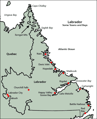
Labrador (/ˈlæbrədɔːr/ LAB-rə-dor) is a geographic and cultural region within the Canadian province of Newfoundland and Labrador. It is the primarily continental portion of the province and constitutes 71% of the province's area but is home to only 6% of its population. It is separated from the island of Newfoundland by the Strait of Belle Isle. It is the largest and northernmost geographical region in the four Atlantic provinces.
Labrador occupies most of the eastern part of the Labrador Peninsula. It is bordered to the west and south by the province of Quebec. Labrador also shares a small land border with the territory of Nunavuton Killiniq Island. The indigenous peoples of Labrador include the Northern Inuit of Nunatsiavut, the Southern Inuit-Métis of NunatuKavut, and the Innu of Nitassinan. Labrador has a roughly triangular shape that encompasses the easternmost section of the Canadian Shield, a sweeping geographical region of thin soil and abundant mineral resources. Its western border with Quebec is the drainage divide of the Labrador Peninsula. Lands that drain into the Atlantic Ocean are part of Labrador, while lands that drain into Hudson Bay are part of Quebec. Labrador's extreme northern tip, at 60°22′N, shares a short border with Nunavut on Killiniq Island. Labrador also has a maritime border with Greenland. Northern Labrador's climate is classified as polar, while Southern Labrador's climate is classified as subarctic. Labrador can be divided into four geographical regions: the North Coast, Central Labrador, Western Labrador, and the South Coast. Each of those regions is described below. North CoastFrom Cape Chidley to Hamilton Inlet, the long, thin, northern tip of Labrador holds the Torngat Mountains, named after an Inuit spirit believed to inhabit them. The mountains stretch along the coast from Port Manvers to Cape Chidley, the northernmost point of Labrador. The Torngat Mountain range is also home to Mount Caubvick, the highest point in the province. This area is predominantly Inuit, with the exception of a small Innu community, Natuashish. The North Coast is the most isolated region of Labrador, with snowmobiles, boats, and planes being the only modern modes of transportation. The largest community in this region is Nain. Nunatsiavut is an Inuit self-government region in Labrador created on June 23, 2005. The settlement area comprises the majority of Labrador's North Coast, while the land-use area also includes land farther to the interior and in Central Labrador. Nain is the administrative centre. Icy Labrador coast and Kiglapait Mountains on the north coast of LabradorCentral Labrador Central Labrador extends from the shores of Lake Melville into the interior. It contains the Churchill River, the largest river in Labrador and one of the largest in Canada. The hydroelectric dam at Churchill Falls is the second-largest underground power station in the world. Most of the supply is bought by Hydro-Québec under a long-term contract. The Lower Churchill Project will develop the remaining potential of the river and supply it to provincial consumers. Known as "the heart of the Big Land", the area's population comprises people from all groups and regions of Labrador. Central Labrador is also home to Happy Valley – Goose Bay. Once a refuelling point for plane convoys to Europe during World War II, CFB Goose Bay is now operated as a NATO tactical flight training site. It was an alternate landing zone for the United States' Space Shuttle. Other major communities in the area are North West River and the large Innu reserve known as Sheshatshiu. Western Labrador Open pit iron mine in Labrador WestThe highlands above the Churchill Falls were once an ancient hunting ground for the Innu First Nations and settled trappers of Labrador. After the construction of the hydroelectric dam at Churchill Falls in 1970, the Smallwood Reservoir has flooded much of the old hunting land—submerging several grave sites and trapping cabins in the process. Western Labrador is also home to the Iron Ore Company of Canada, which operates a large iron ore mine in Labrador City. Together with the small community of Wabush, the two towns are known as "Labrador West". South CoastNunatuKavutFrom Hamilton Inlet to Cape St. Charles/St. Lewis, NunatuKavut is the territory of the NunatuKavummiut or Central-Southern Labrador Inuit (formerly known as the Labrador Métis) It includes portions of Central and Western Labrador, but more NunatuKavummiut reside in its South Coast portion: it is peppered with tiny Inuit fishing communities, of which Cartwright is the largest. The Labrador StraitsFrom Cape Charles to the Quebec/Labrador coastal border, the Straits is known for its Labrador sea grass (as is NunatuKavut) and the multitude of icebergs that pass by the coast via the Labrador Current. Red Bay, LabradorRed Bay is known as one of the best examples of a preserved 16th-century Basque whaling station. It is also the location of four 16th-century Spanish galleons. The lighthouse at Point Amour is the second-largest lighthouse in Canada. MV Kamutik, a passenger ferry between the mainland and St. Barbe on the island of Newfoundland, is based in Blanc Sablon, Quebec, near the Labrador border. L'Anse-au-Loup is the largest town on the Labrador Straits. L'Anse-au-Clair is a small town on the Labrador side of the border. Time zones of LabradorMost of Labrador (from Cartwright north and west) uses Atlantic Time (UTC−4 in winter, UTC−3 in summer). The south eastern tip nearest Newfoundland uses Newfoundland Time (UTC−3:30 in winter, UTC−2:30 in summer) to stay co-ordinated with the more populous part of the province. Climate of LabradorFurther information: Geography of Newfoundland and LabradorMost of Labrador has a subarctic climate. but northern Labrador has a tundra climate (ET) and Happy Valley - Goose Bay has a humid continental microclimate. Summers are typically cool to mild across Labrador and very rainy, and usually last from late June to the end of August. Autumn is generally short, lasting only a couple of weeks and is typically cool and cloudy. Winters are long, cold, and extremely snowy, due to the Icelandic Low. Springtime most years does not arrive until late April, with the last snow fall usually falling during early June. Labrador is a very cloudy place, with sunshine levels staying relatively low during spring and summer due to the amount of rain and clouds, before sharply dropping off during September as winter draws nearer. Natural featuresLabrador is home to a number of flora and fauna species. Most of the Upper Canadian and Lower Hudsonian mammalian species are found in Labrador. Notably the Polar bear (Ursus maritimus) reaches the southeast of Labrador on its seasonal movements. |
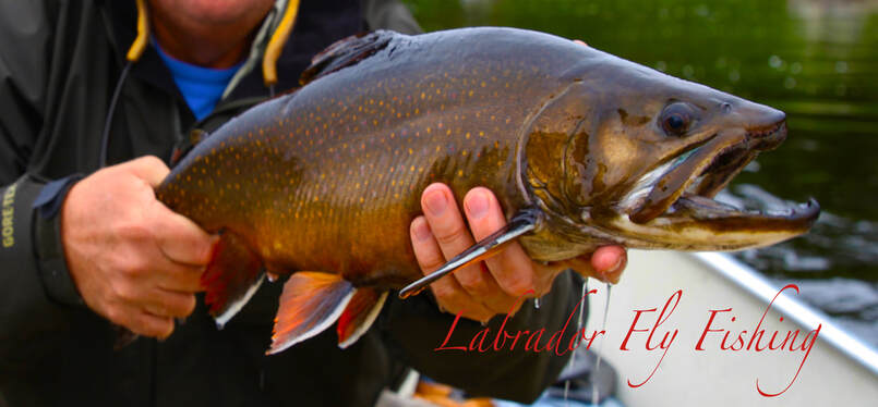
Labrador Hosted Trips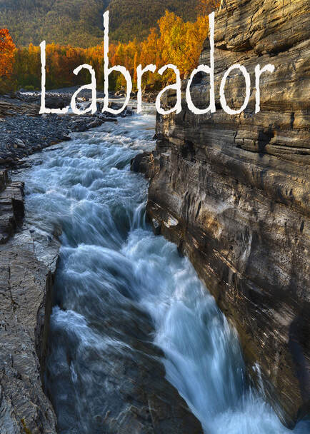
|